
Via Ferrata Oskar-Schuster (Plattkofel)
Tackling the via ferrata Oskar-Schuster to the top of Sasso Piatto (Plattkofel) is a fantastic way to appreciate the size and mightiness of the Sassolungo group.

Tourinfo
7 h
3 h 30 min
3 h 30 min
12,0 km
780 m
1250 m
2964 m
- January
- February
- March
- April
- May
- June
- July
- August
- September
- October
- November
- December
Introduction
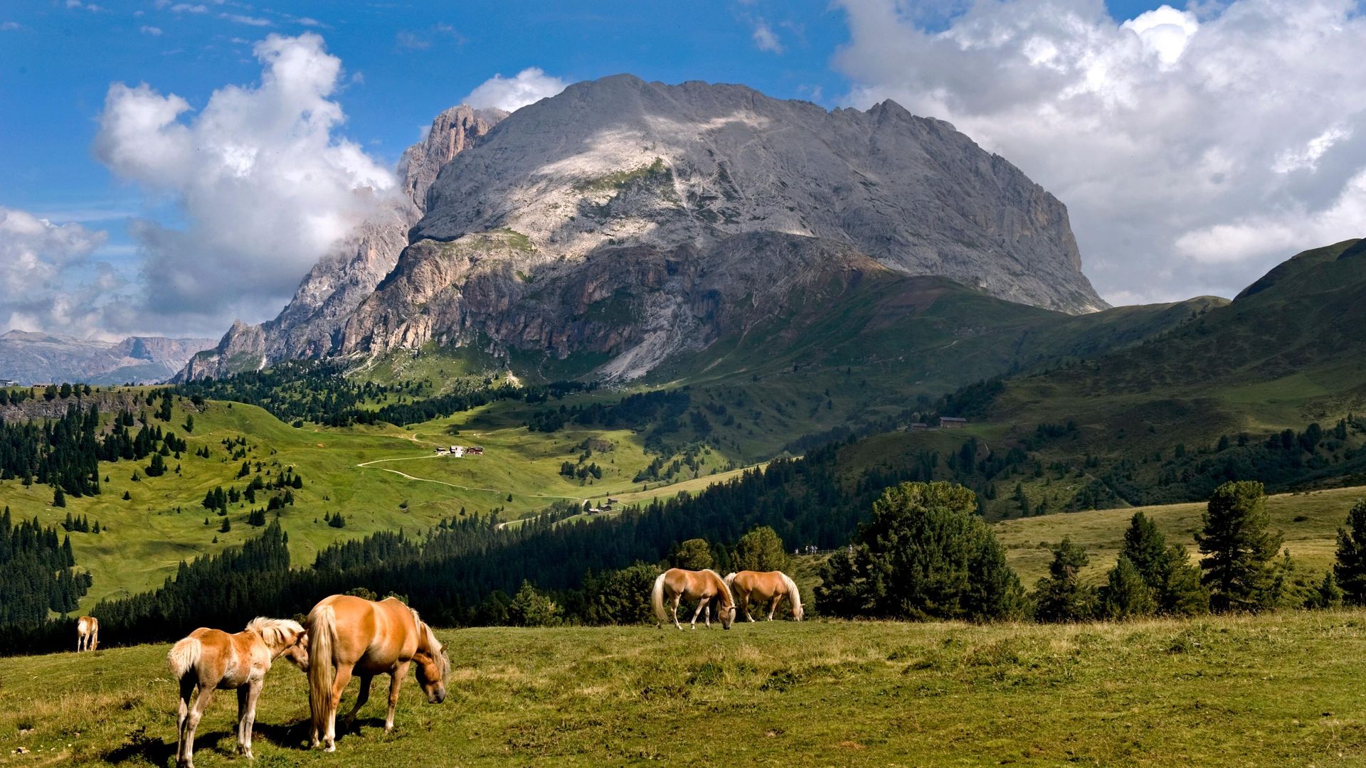
The Sassolungo group may count as a small mountain range in the Dolomites, but it definitely offers worthy climbing and hiking destinations. The Sassolungo is not only Val Gardena’s emblem, but one of the most impressive rock formations in the world. You are going to cross the entire mountain range, and be rewarded with a breathtaking view from the top.
 Zoom
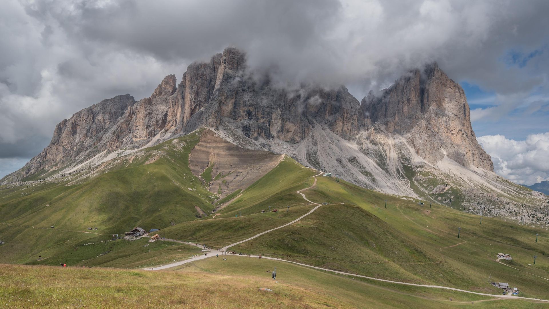
Zoom The descent represents a challenge in itself, and leads all the way to the Sella Pass. But there is no question: Climbing the via ferrata Oskar-Schuster is going to create memories that will last you a lifetime. Don’t underestimate the length of this tour, and tackle it only in good weather!
Drive
Coming from the Autostrada del Brennero (A22) highway, drive through Val Gardena (SS242) until Plan de Gralba, then take the right junction and drive to the top of Passo Sella. Right after the Hotel Passo Sella, you’ll find a parking lot (subject to charge).
During summer, the mountain passes in the Dolomites are very easy to access using public transportation. Bus line 471 leaves the towns of Ortisei, Santa Cristina and Selva every 30 minutes. Find the detailed timetables here.
Access
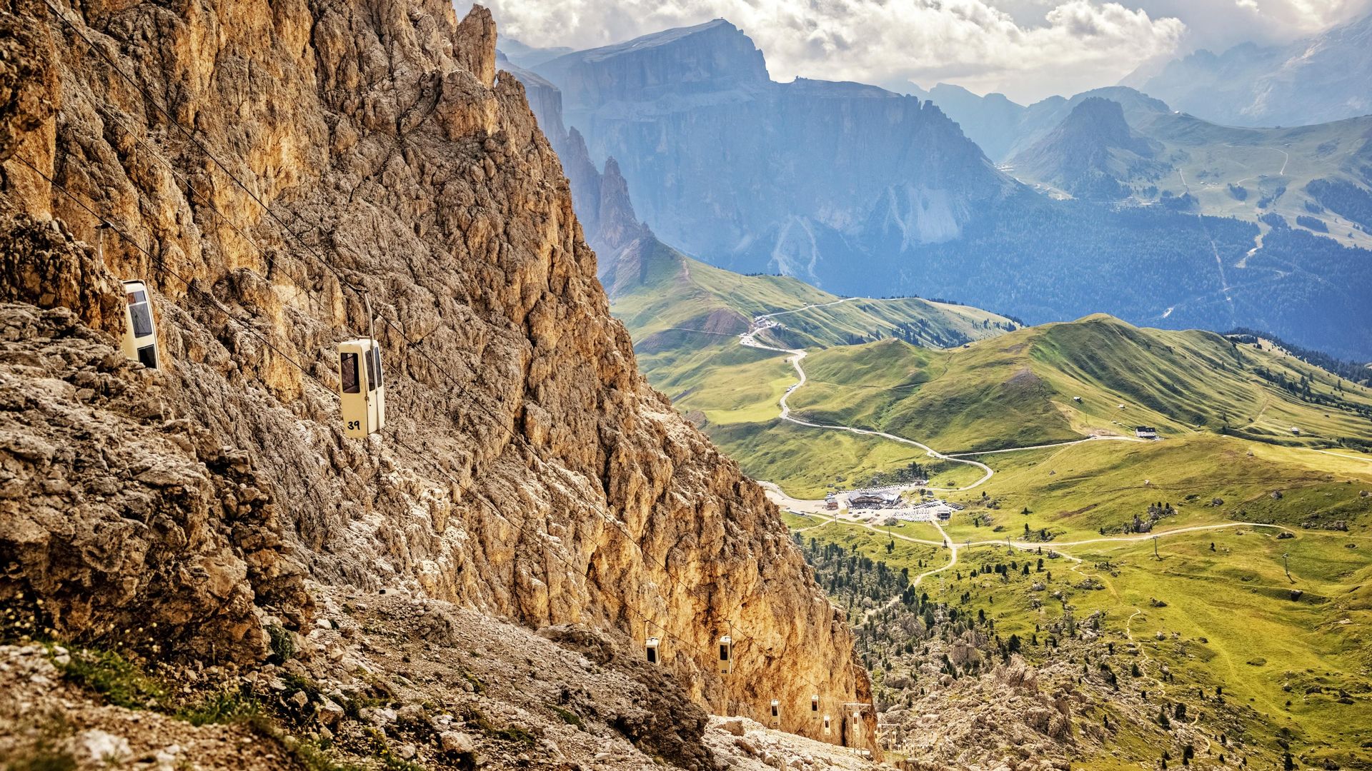
The Oskar-Schuster via ferrata is located high in the mountains, which is why it will take a while to get to the starting point. The quickest option is to take the little funicular from Passo Sella. It will take you to the Forcella del Sassolungo. Feel free to have a coffee break at the Toni Demetz mountain hut. It’s going to be a long tour from here.
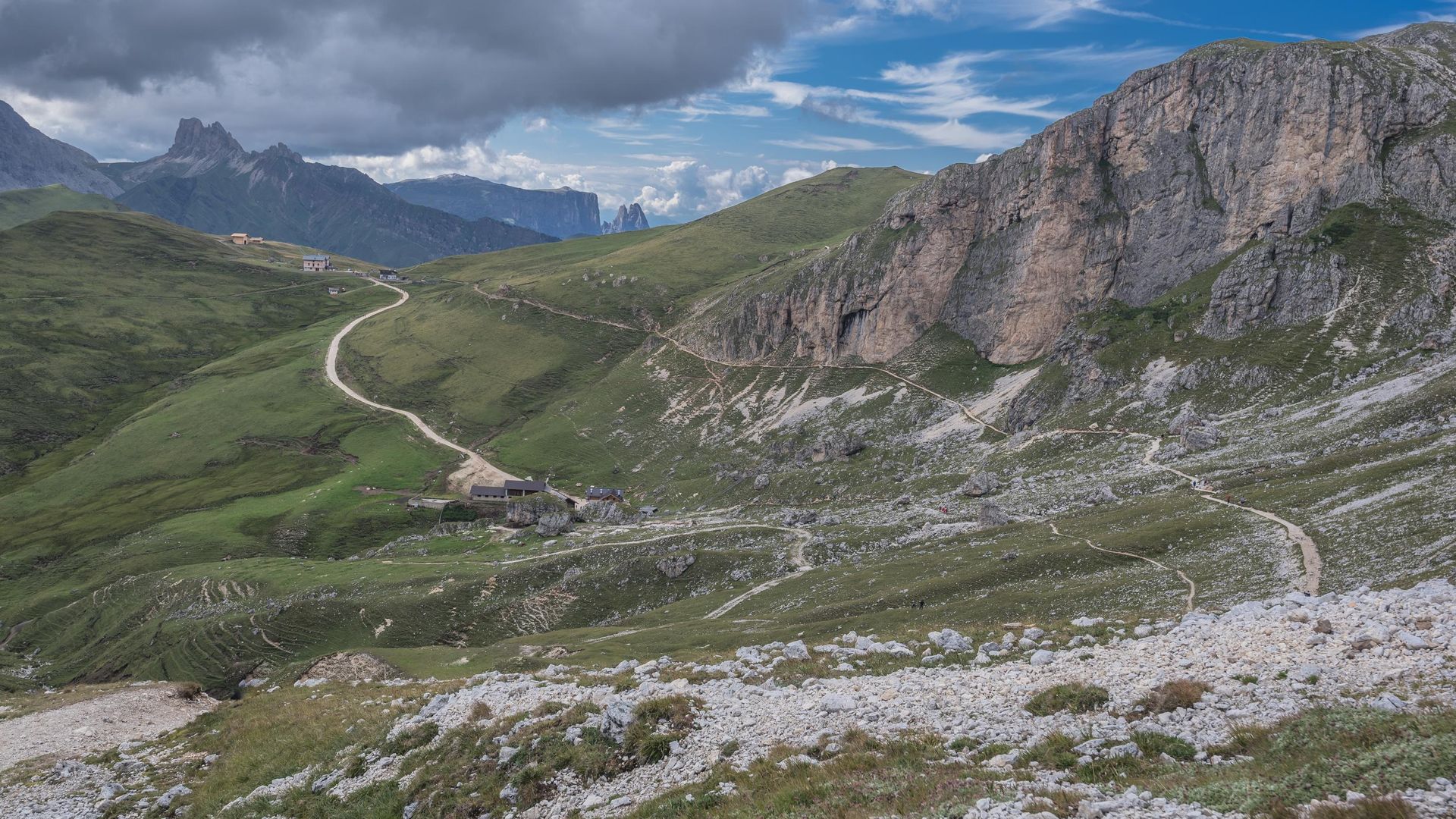
From the Forcella, start descending along trail nr. 525 until you reach the Rifugio Vicenza (2,253 m / 7,400 ft.), where you will turn left (south) and soon reach the starting point of the via ferrata.
 Zoom
Zoom  Zoom
Zoom 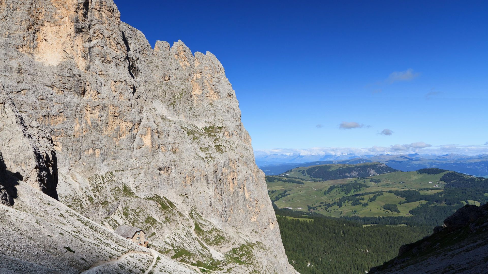 Zoom
Zoom 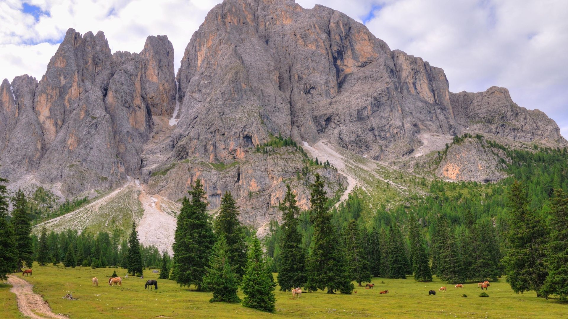 Zoom
Zoom 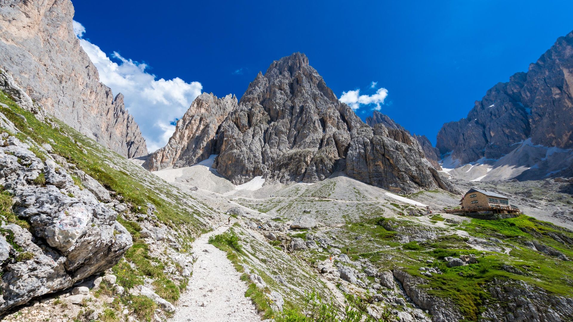 Zoom
Zoom Another way to get there is to start from Monte Pana. This option is slightly longer and more straining. You can reach Monte Pana by car or chairlift from Santa Cristina. From there, follow trail nr. 30 in direction Alpe di Siusi. After about 2 km (1.25 miles), turn left on trail nr. 525. Leading through the forest, it will take you to Rifugio Vicenza and the starting point of the climb.
Description
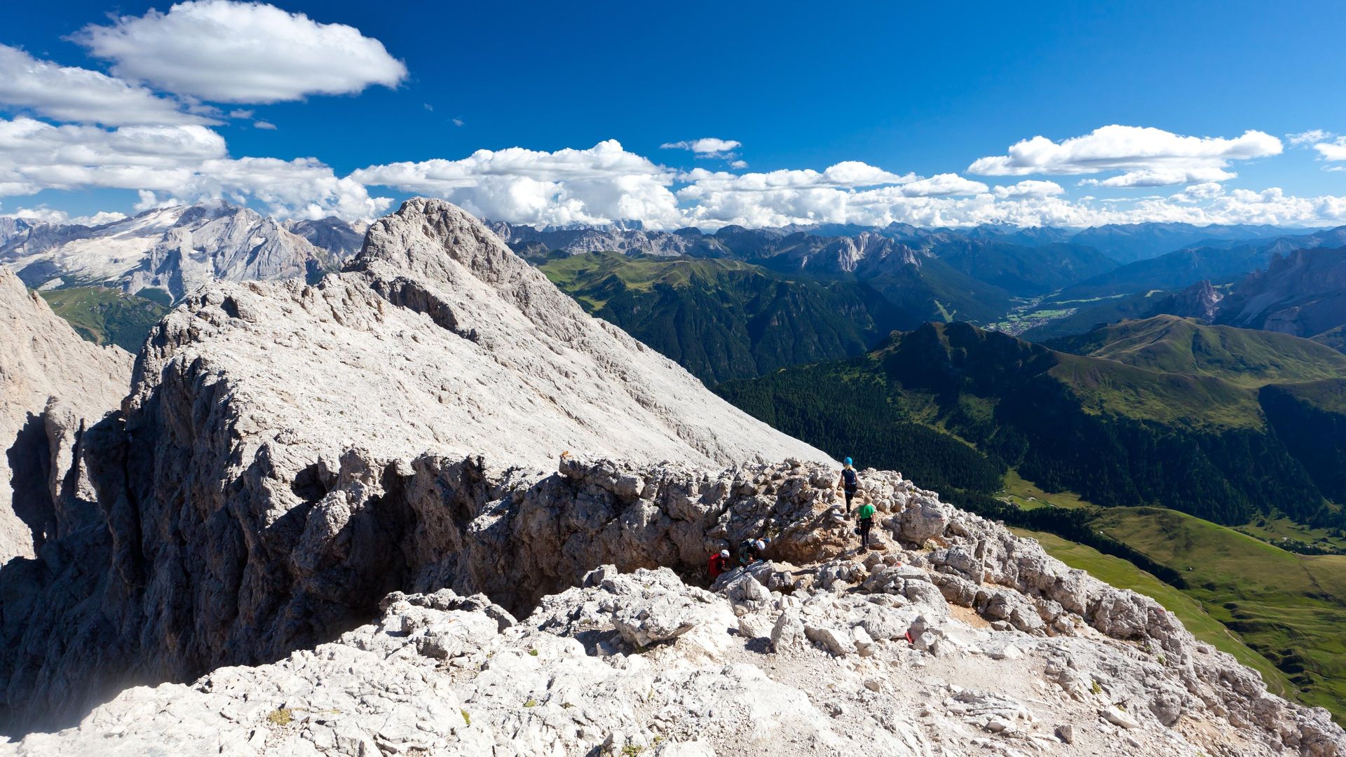
Right at the start, you may have to cross a short panel of leftover snow from the winter. After that, you’ll soon come across the first steel cables. Follow them up the ramp (to the right). After a short first climb, you’ll reach a flat spot and will have to hike untill you reach a small terrace.
Note: Up to 2011, the via ferrata led to the right form the terrace. Because of a rockslide, a new, safe route has been established.
The via ferrata continues along a few steep climbs, always equipped with cables and iron clamps, until you reach a ladder crossing a crevice. You’ll see a statue of the virgin Mary here.
The last part of the climb is not overly hard, and it leads to the peak without any more steel cables. Red dots on the rocks will lead the way. You will soon reach the cross and be able to marvel at a wonderful Dolomite panorama in 360 degrees.
 Zoom
Zoom 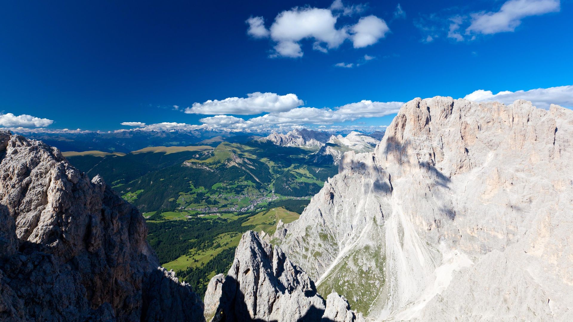 Zoom
Zoom 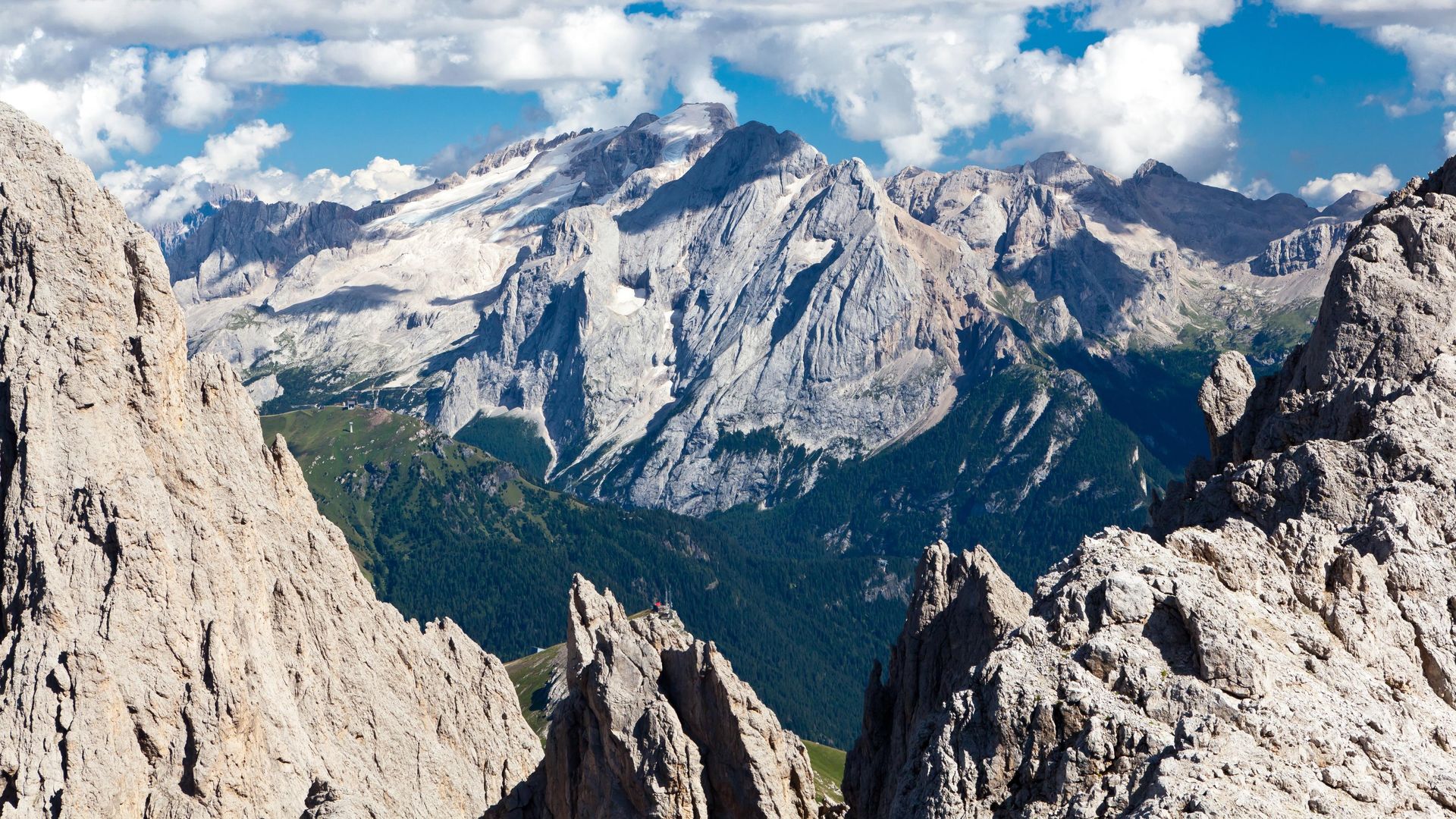 Zoom
Zoom 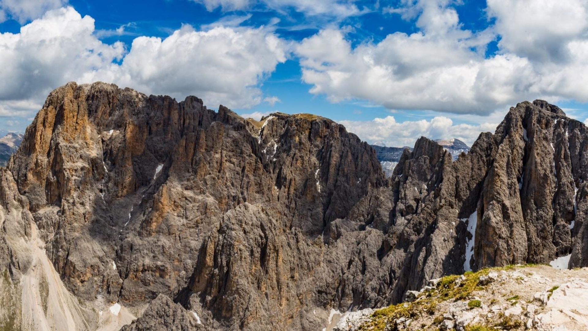 Zoom
Zoom Descent
The way down is not overly hard but quite long. From the peak, you can look down at an endless flank of boulders and rocks, and a long trail leads down to the alpine meadows at the foot of the Sasso Piatto. Once you’ve reached the Plattkofelhütte (Plattkofel Refuge - 2,300 m / 7,545 ft.), the hardest part is done. The hut offers excellent snacks like homemade butter and cheese.
To get back to Passo Sella, you’ll have to take the Friedrich-August-Weg (trail nr. 527). It is quite flat and runs all along the southern side of the Sassolungo group. Once you get to the Friedrich-August mountain hut, you’ve almost made it. Only the descent to the pass is left.
Insider-Tip
Along this tour, you’ll come across six mountain huts, all of them offering excellent local cuisine. A stop at any of them is optional, of course, but it might help to divide this excursion into multiple stages and rest a little along the way!
The via ferrata Oskar-Schuster will take you to an altitude of almost 3,000 m / 10,000 ft. It’s important to only tackle this tour if the weather is decidedly favourable. Be prepared to encounter some snow, especially in early June and September.
Video

Maps
- Tabacco Nr. 05, Gröden / Seiser Alm. The tabacco maps are available in their app.
- Kompass WK59, Sellagruppe
Guides
- „Klettersteige für Einsteiger Südtirol-Dolomiten-Gardasee“, Christjan Ladurner, Tappeiner
- „Klettersteigführer Dolomiten-Südtirol-Gardasee“, Axel Jentzsch-Rabl, Andreas Jentzsch, Dieter Wissekal, Alpinverlag


