
Puez-Tour at Puez-Odle Nature Park
The Puez-Tour starts at Passo Gardena, crosses the Puez plateau and finally descends into Vallunga, reaching Selva.

Tourinfo
6 h
1 h
2 h 30 min
15,0 km
330 m
980 m
2512 m
- January
- February
- March
- April
- May
- June
- July
- August
- September
- October
- November
- December
Introduction
The Puez-Tour is a particularly beautiful excursion and a unique opportunity to discover the marvelous Puez-Odle Nature Park. You’ll also be hiking along a section of one of the most popular ”high routes” of the Dolomites – trail nr. 2.
The Puez-Tour is long but not excessively demanding, as it does not have particularly long ascents. Despite this, the excursion should not be underestimated, as there are not many shortcuts to take if you get tired.
Drive
From the Autostrada del Brennero (A22) highway, drive through Val Gardena (SS242) to Selva, at the valley station of the Dantercepies cable car. Here, you will find an underground car park (ticket is free if you purchase a cable car ticket).
In summer, the mountain passes of the Dolomites are excellently served by public transportation. Line 350 departs from Ponte Gardena or Chiusa to Selva every 30 minutes. In Selva you can change to line 357 and go directly to the valley station of the Dantercepies cable car.
Those wishing to avoid taking the lift can change bus and reach Passo Gardena with the 472 line bus. The journey thus lengthens a bit, and the altitude difference of the excursion increases by about 100 meters. For detailed schedules, see SüdtirolMobil.
Suggestions for accommodations


Description
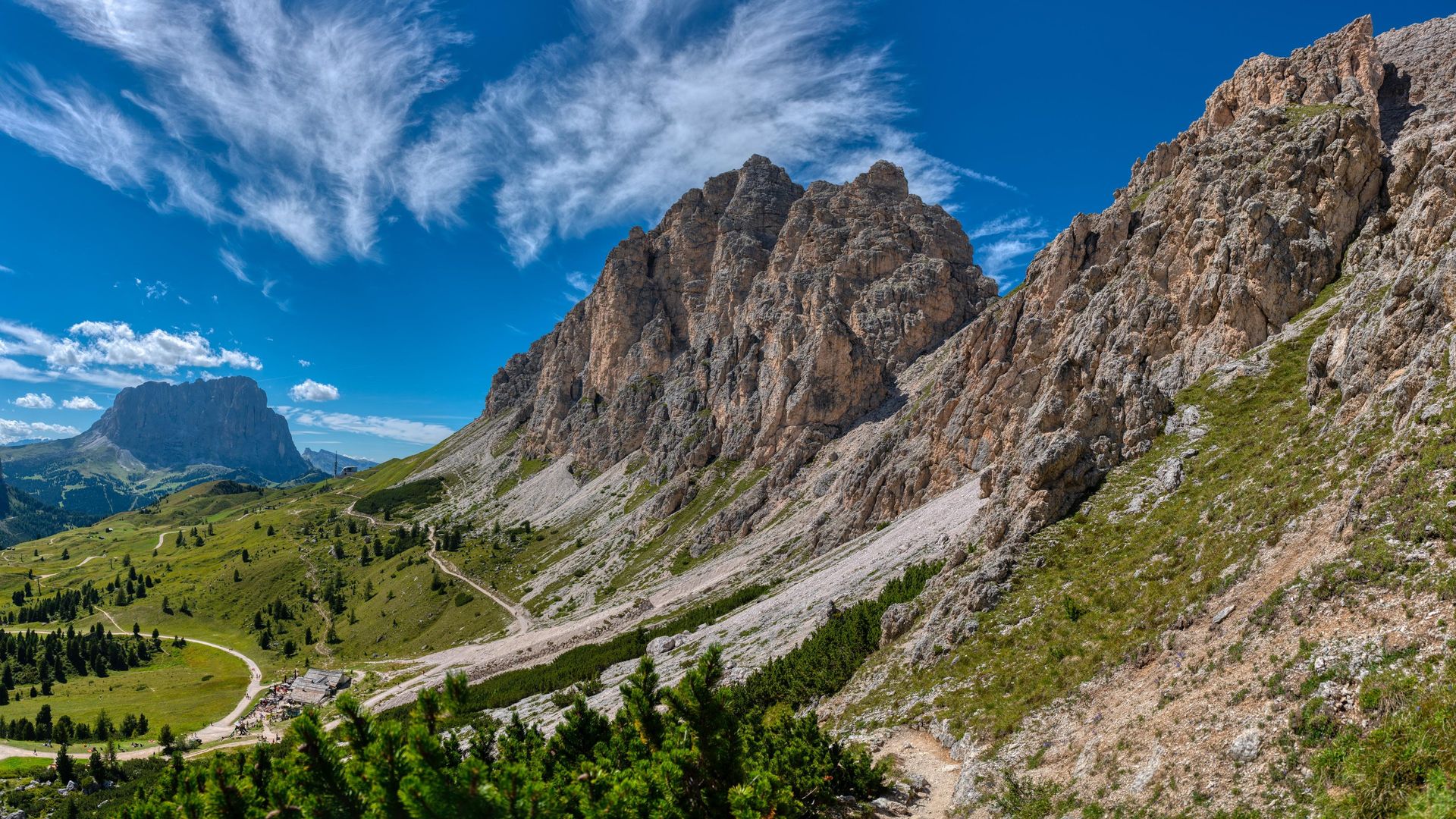
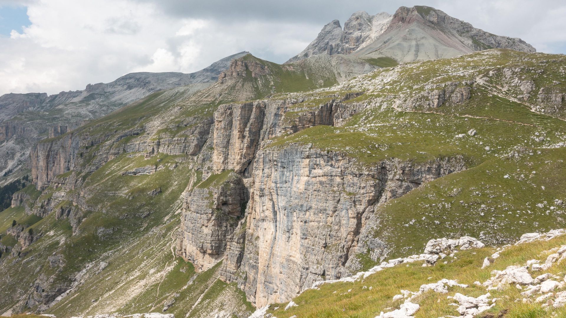
From the Dantercepies mountain station take trail 12A in Eastern direction, following the signs to Baita Jimmi (2,220 m / 7,217 ft.). From there you’ll start following famous trail nr. 2, initially uphill until Passo del Cir (2,469 m / 8,100 ft.). From the top you can enjoy a spectacular view of Val Chedul and the Odle mountains.
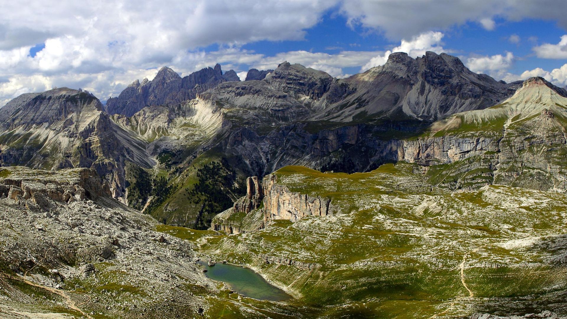
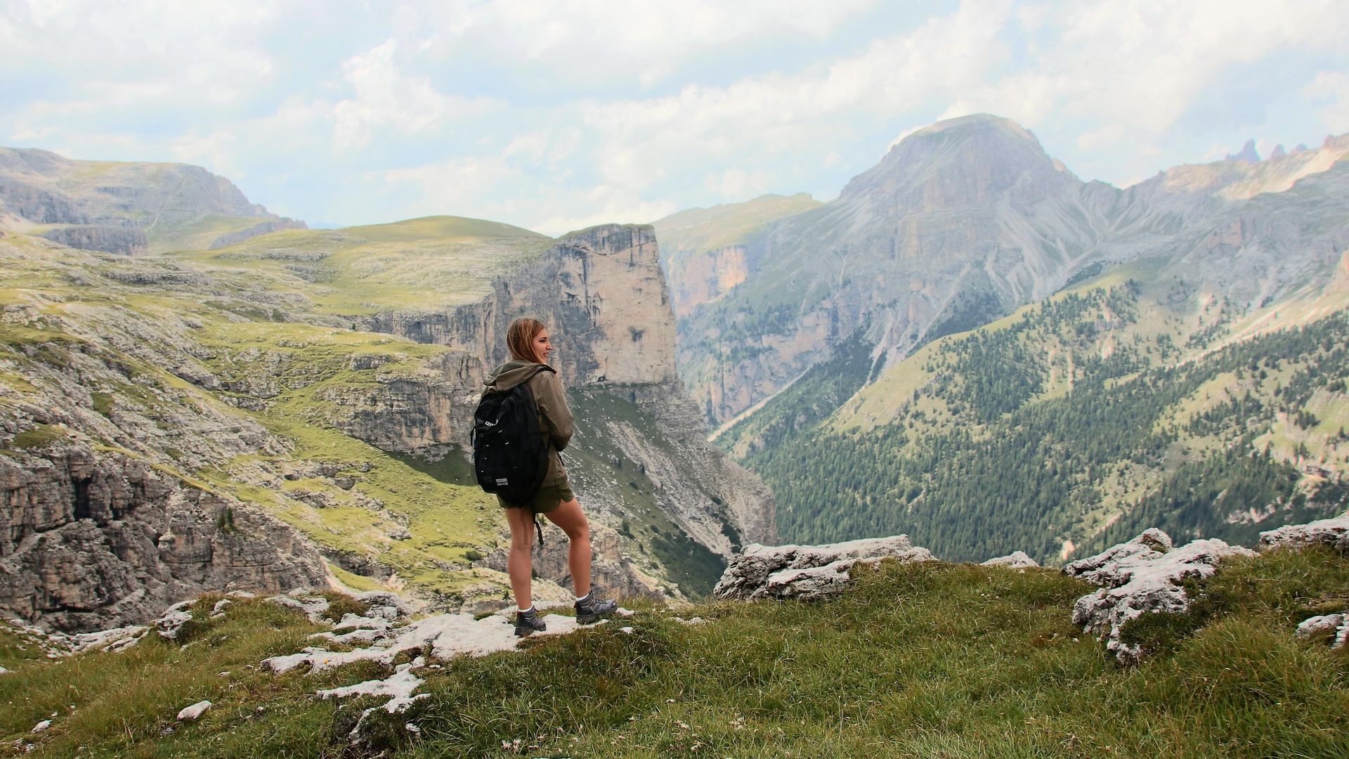
Trail 2 then continues, without much altitude difference, until Passo Crespëina (2,528 m / 8,293 ft.), where you’ll have to tackle one of the few steep ascents of the tour. At the end, though, you’ll be handsomely rewarded with a fantastic view of the Puez plateau: a vast landscape of rocks reminiscent of a moon landscape.
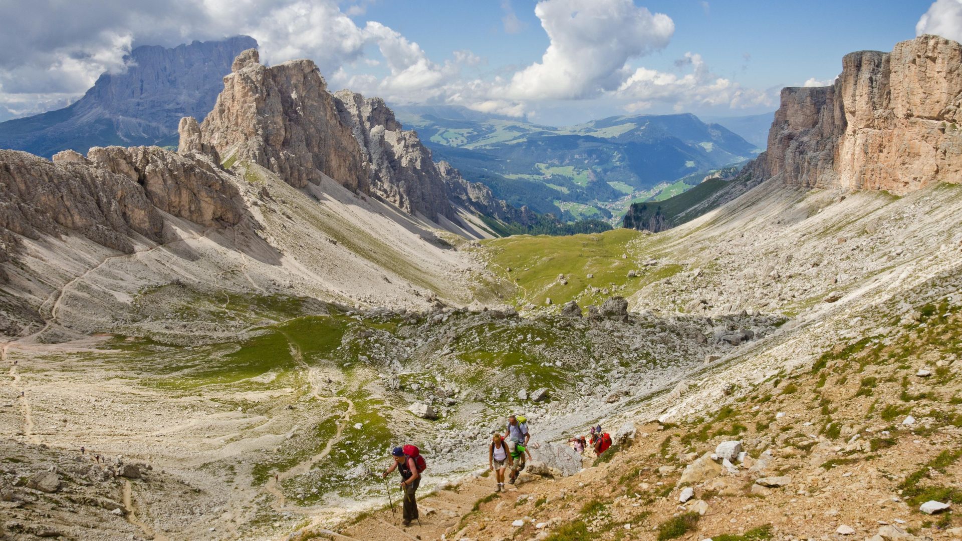
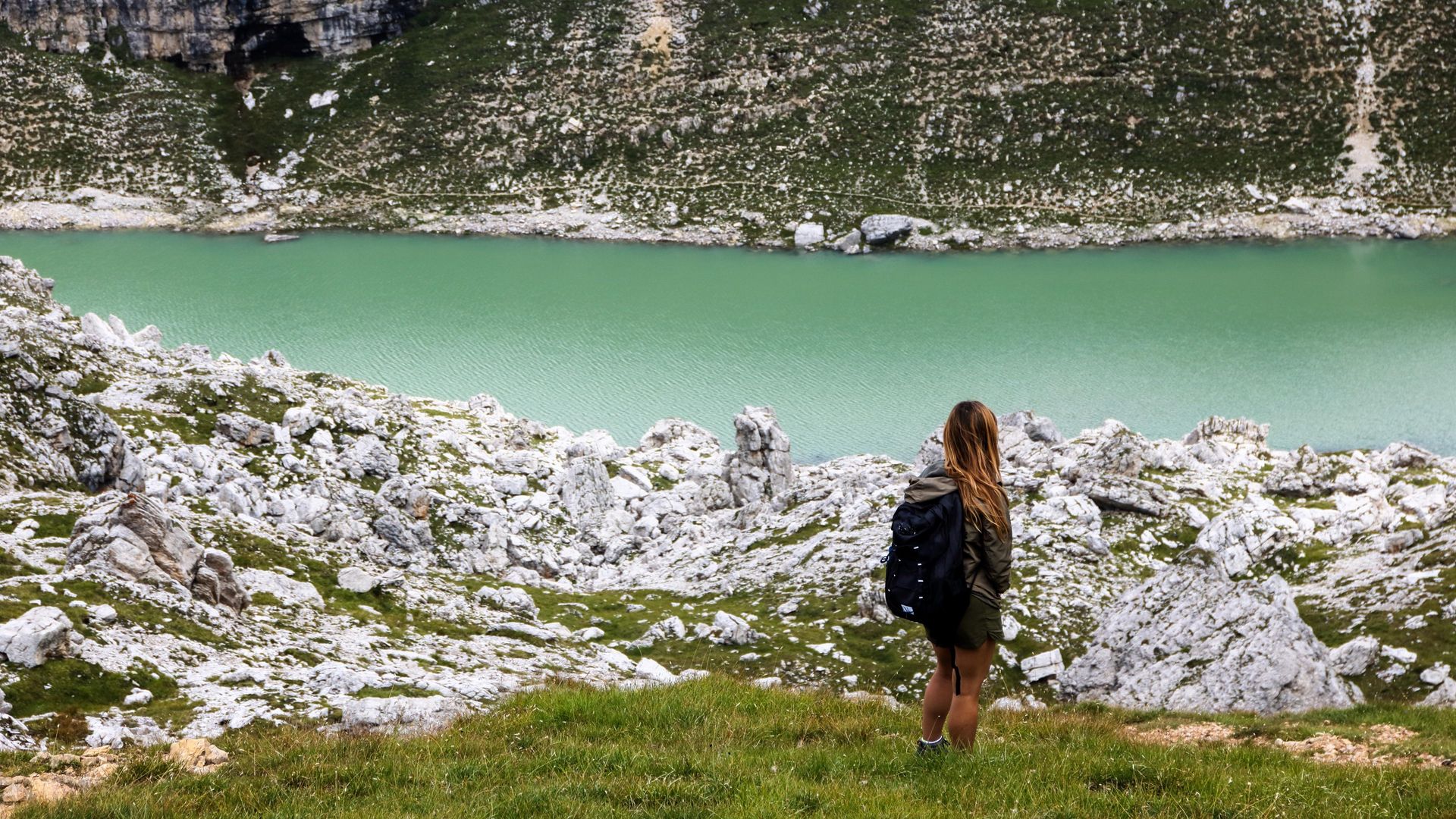
Continue downhill along trail nr. 2 and you’ll soon reach the small lake of Crespëina (2,374 m / 7,788 ft.). This incredible place is the perfect place to take a break, and if you’re not afraid of the cold water, you’re welcome to take a refreshing bath.
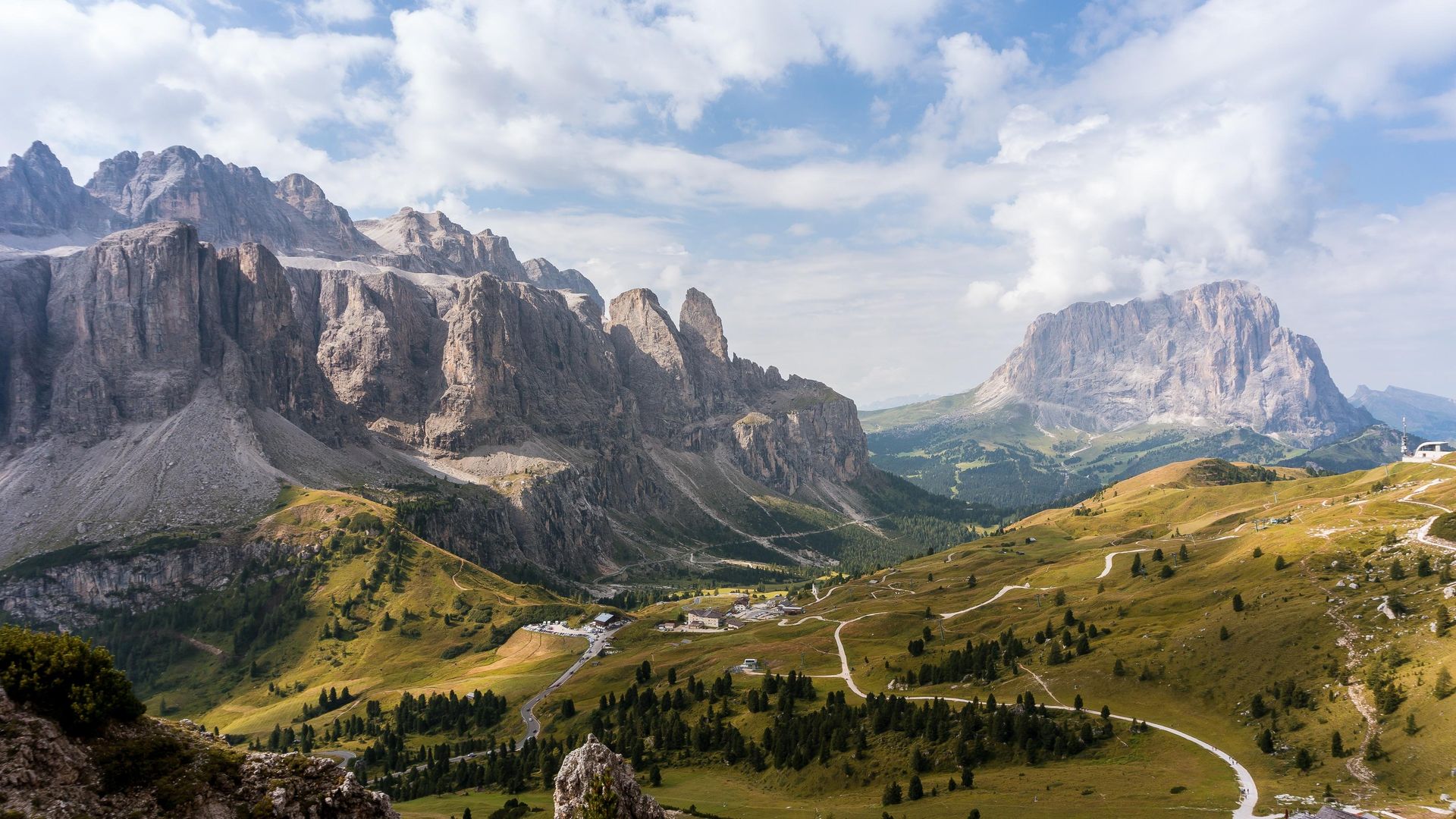
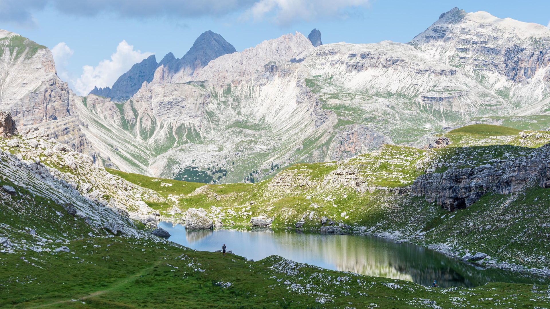
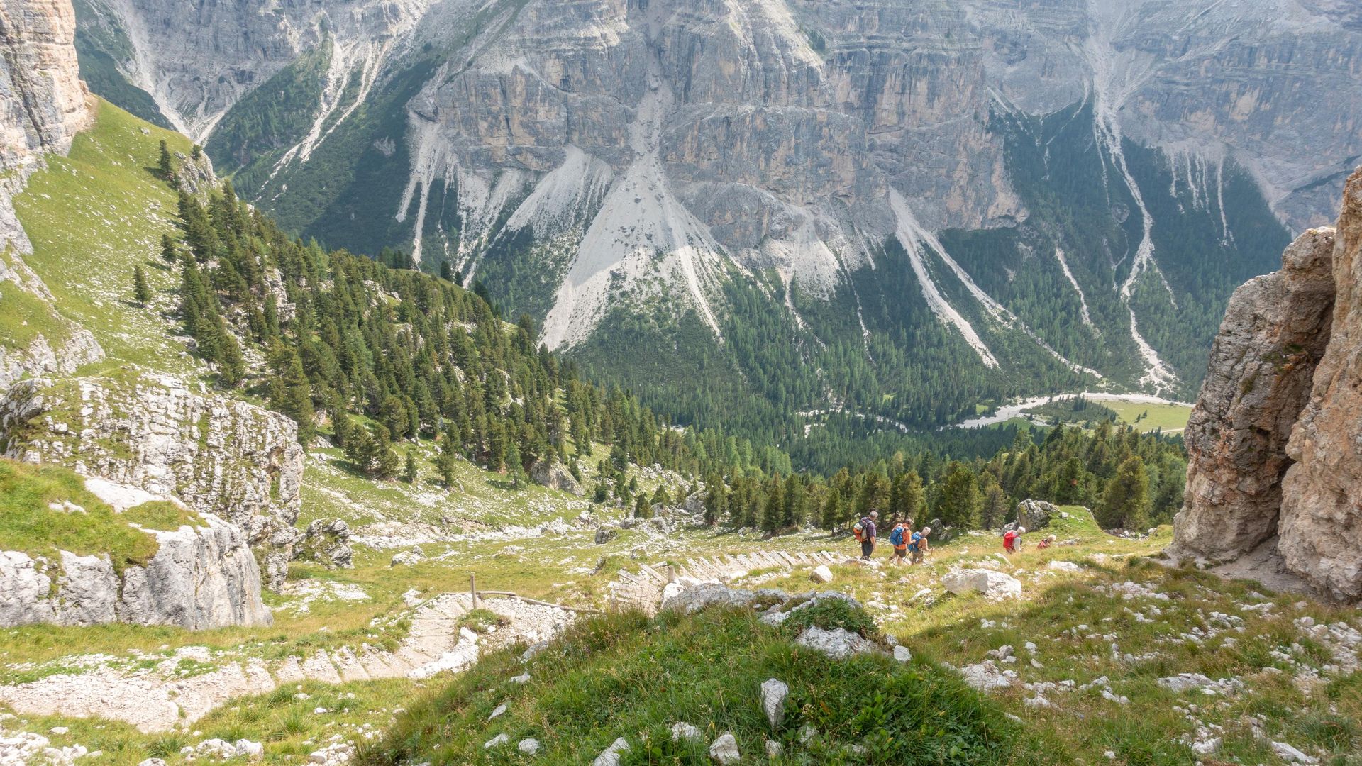
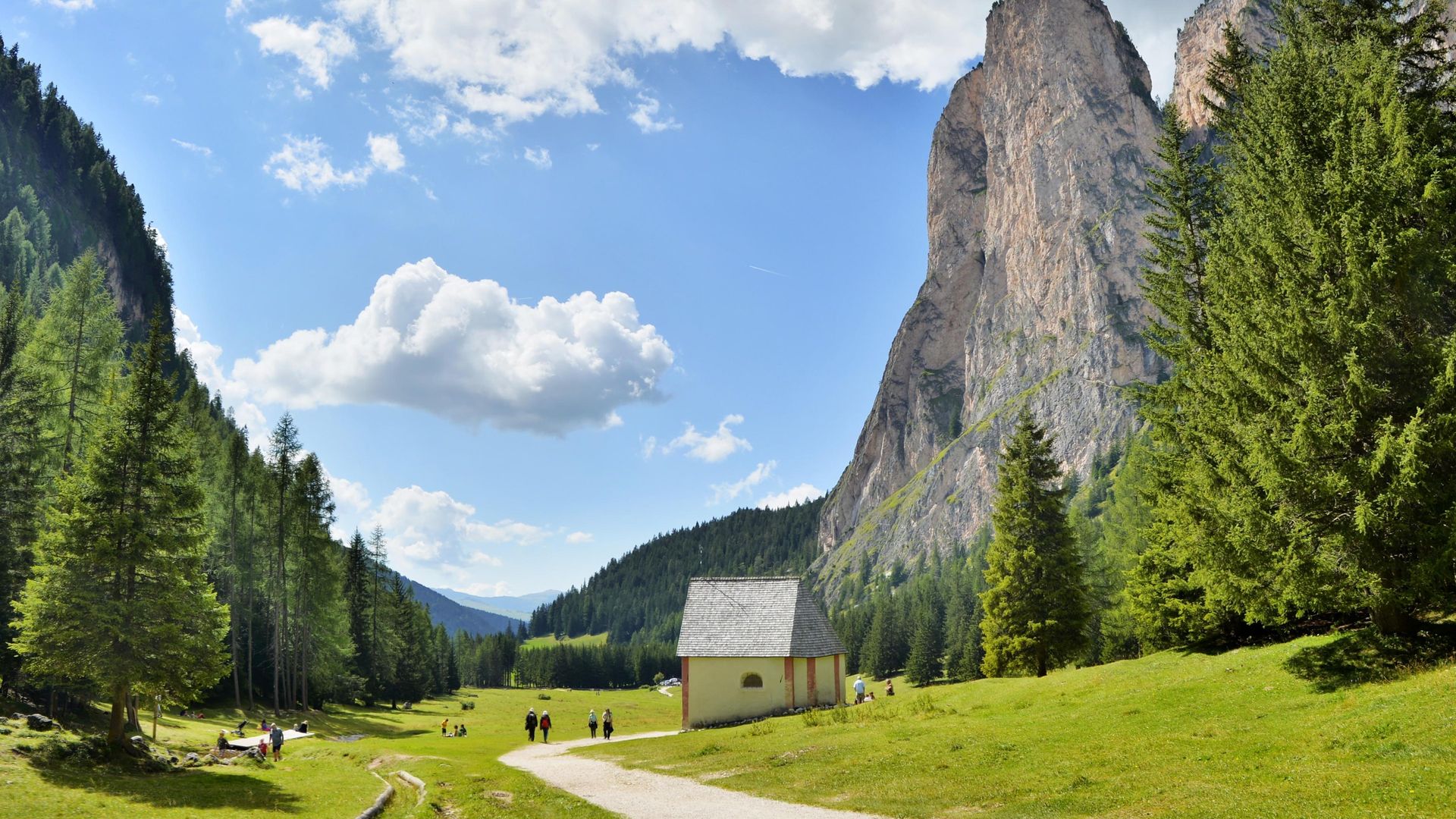
From the lake the path along the Puez plateau continues flat until Furcela de Ciampëi (2,366 m / 7,762 ft.). The beautiful Valle Stella Alpina, situated to your right, leads all the way to Corvara in Alta Badia. To the left, on the other hand, trail nr. 14A leads back into Val Gardena. This path is very steep at first and leads down in a dense serpentine. Follow it if you’re tired - once you reach the pastures of Vallunga it’s just a leisurely downhill stroll back to Selva and the Dantercepies valley station. This represents the short variant of the Puez-Tour.
For those who still have energy left, on the other hand, we highly recommend to continue on trail nr. 2 until Rifugio Puez (there are no more steep passages). The hut is open during the summer months and is a great place to enjoy a meal and catch a break. Once you’re ready to get back to Val Gardena, follow trail nr. 16. It will lead you from Rifugio Puez into Vallunga, and finally to Selva.
Insider-Tip
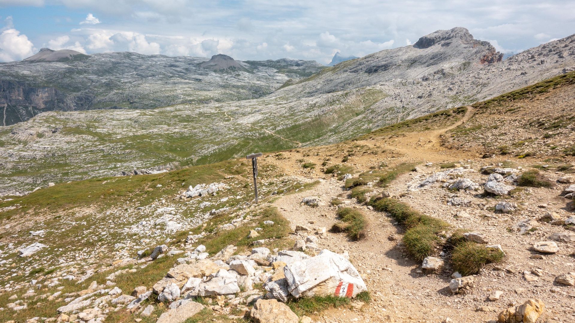
The Puez-Tour partly runs along the revered “alta via” (high route) nr. 2, a long multi-day-hike that crosses the Dolomites in several stages. If you have the time and are in good physical condition, you can extend this hike to Seceda. It’s possible to do this in a day from the Gardena Pass if you just start early enough and keep a good walking pace. But you can also take it easy and spend a night at Rifugio Puez, dividing the excursion into two segments.
If you’re up for the challenge and wish to continue to Seceda, simply stay on trail nr. 2 when you reach Rifugio Puez, heading West. You can even add another detour along trail 3A or 3B and climb Piz Duleda (2,909 m / 9,543 ft.). Trail nr. 2 eventually passes through Furcela de Sieles (2,528 m / 8,293 ft.), where you’ll have to overcome a few exposed passages, but don’t worry – it’s all secured with steel ropes. From Furcela de Sieles you’ll descend to the Cisles pasture and will soon reach Rifugio Firenze, from which you can continue to Col Raiser mountain station and take the cable car back to Santa Cristina, or walk all the way back to town.
Maps
- Tabacco Nr.05, Gröden-Val Gardena or Nr. 07, Alta Badia, Arabba, Marmolada. The tabacco maps are available in their app.
- AV-Map Nr. 52/I


