
Crossing of the Sella group with Piz Boè
Crossing the Sella is an incredible experience: you'll hike among stunning high alpine environments, enjoy wonderful views and tackle quite a few challenging passages.

Tourinfo
6 h
1 h 30 min
3 h
5,8 km
400 m
1140 m
3152 m
- January
- February
- March
- April
- May
- June
- July
- August
- September
- October
- November
- December
Introduction
Crossing the Sella with ascent of Piz Boè (3,152 m) is an absolute royal stage among the hikes that can be undertaken in Val Gardena. However, it is less a hike than an alpine tour that is second to none. This is definitely an excursion not to be missed.
 Zoom
Zoom Drive
This is a crossing, meaning you will not end up on the same side of the mountain as you started. One solution is to reach Passo Pordoi from Val Gardena by bus (Line 471) and, at the end of the excursion, take the bus from Passo Gardena back into Val Gardena. However, we highly recommend taking a taxi to Passo Pordoi (especially for groups). This will allow you to be among the first at the ropeway when it opens at 8.30 AM. If you take the bus, don't expect to be there before 10 AM. For detailed schedules, see SüdtirolMobil.
Suggestions for accommodations


Description
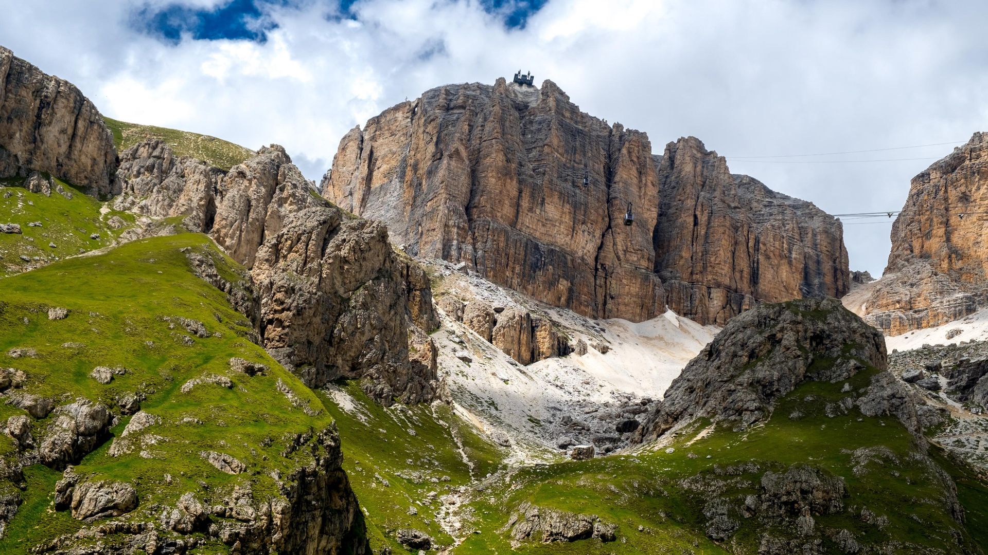
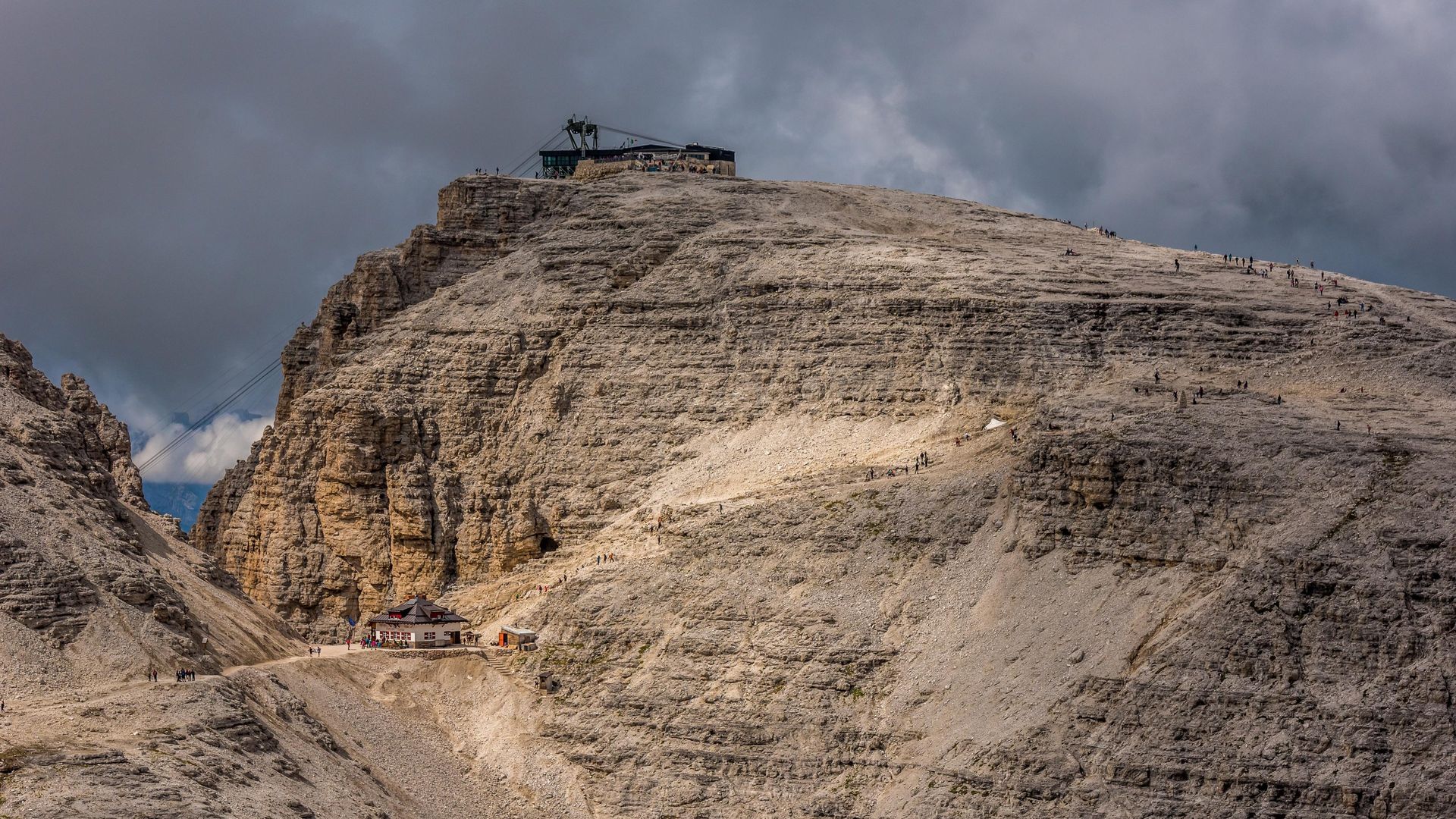
Getting to the top of Sas Pordoi is very easy thanks to the ropeway. Since the excursion ahead is quite long, it is worth taking it. Those who are very fit, on the other hand, are welcome to take trail Nr. 627, following directions to Rifugio Forcella Pordoi (2,829 m/9,281 ft.). This will add about one and a half hours to your walking time.
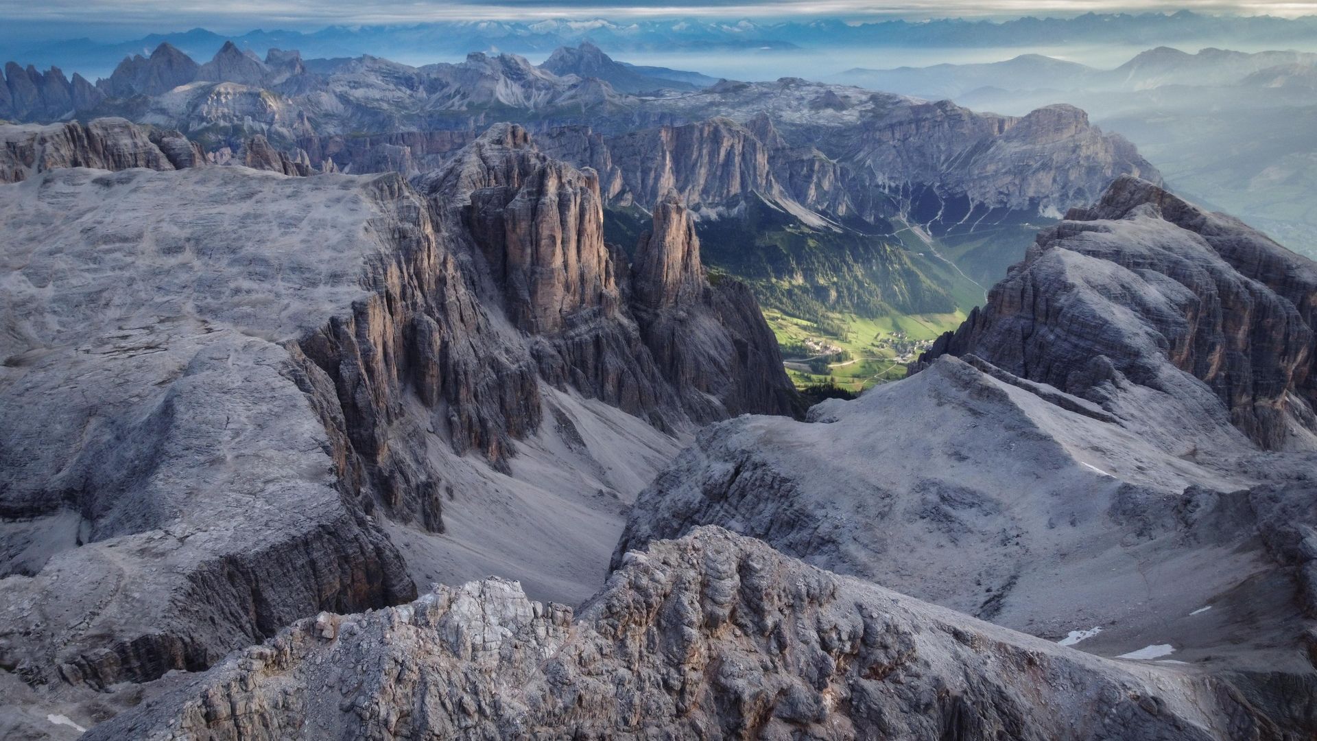
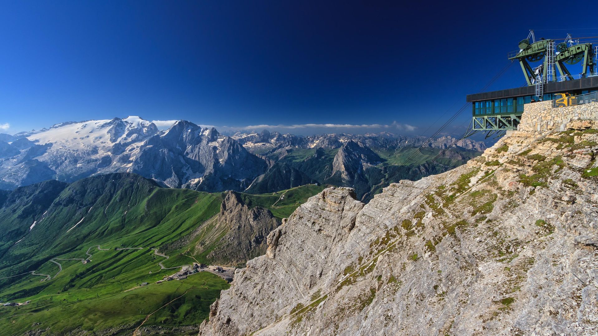
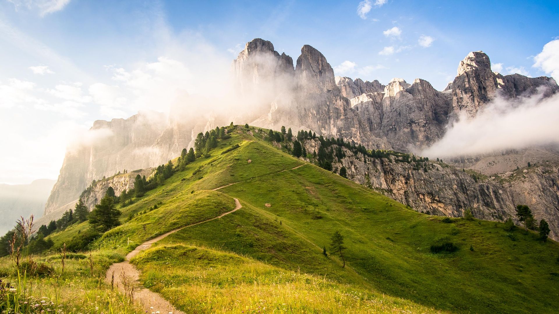
From the mountain station of Sas Pordoi you can already admire the Sella massif in all its spectacular beauty: ahead of you lies a rocky landscape crossed by deep valleys and decorated with countless towers. The view reaches all the way to nearby Dolomitic giants such as Sassolungo, Marmolada and Monte Civetta.
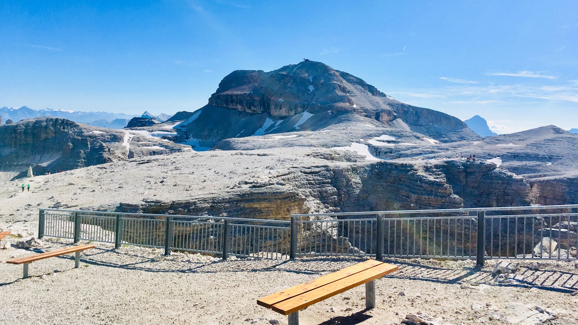
Reday to go? Great! Start following trail Nr. 627 - it covers most of the excursion and constitutes part of high route Nr. 2. A few hundred meters after you pass Rifugio Pordoi you have the opportunity to climb to the top of Piz Boè (3,152 m / 10,341 ft.) by following trail Nr. 638. The path to the top is steep and partly bumpy.
However, the most difficult parts have been secured with steel ropes and, once you get to the top, the spectacular view easily makes up for the effort. You can descend on the other side of the peak and re-join trail Nr. 627 at Rifugio Boè (2,873 m). From here, you can also take a peek of Val de Mesdì, an excellent and very popular freeride destination in winter.
 Zoom
Zoom 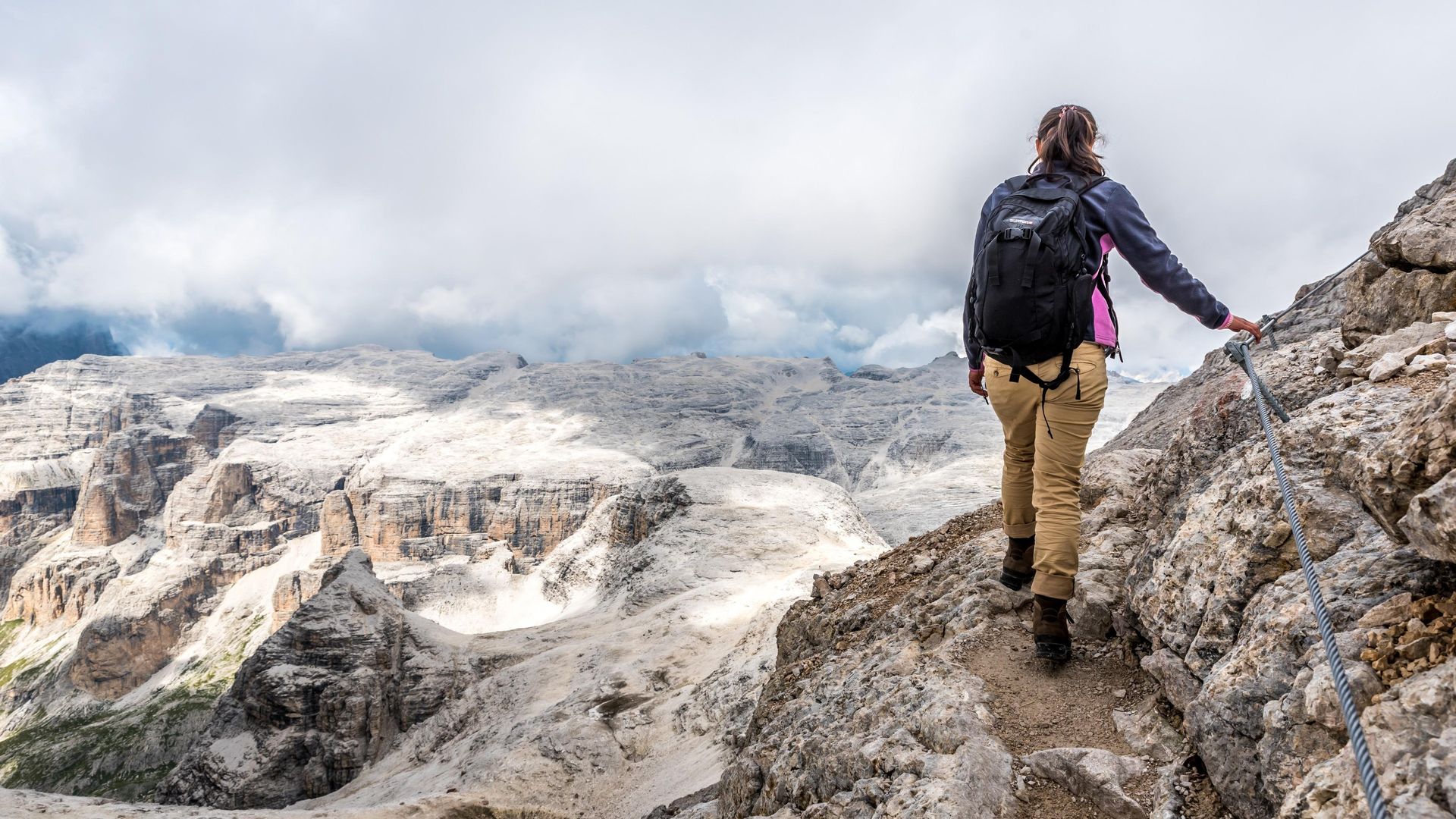 Zoom
Zoom  Zoom
Zoom 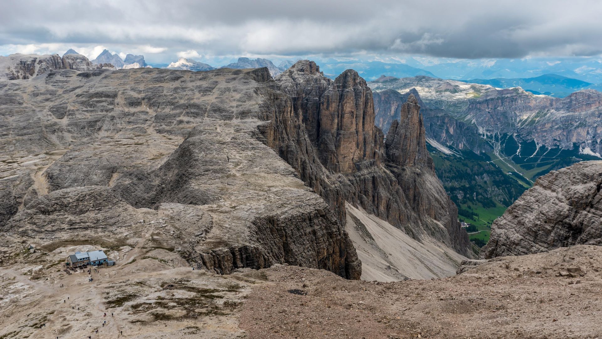 Zoom
Zoom The excursion continues northwards in direction Rifugio Franco Cavazza. From Rifugio Boè, follow trail Nr. 647 for a few hundred meters, then turn right, along trail Nr. 666 and follow the directions towards Rifugio Franco Cavazza. Parts of the upcoming path are challenging but secured by steel ropes.
Surrounded by high Dolomite walls, the picturesque Pisciadù lake suddenly appears in sparkling turquoise among the rocks. Situated next to it you will find Rifugio Franco Cavazza, where you can enjoy a well-deserved rest. The ferrata Pisciadù / Tridentina ends here, which makes it a very popular destination.
 Zoom
Zoom 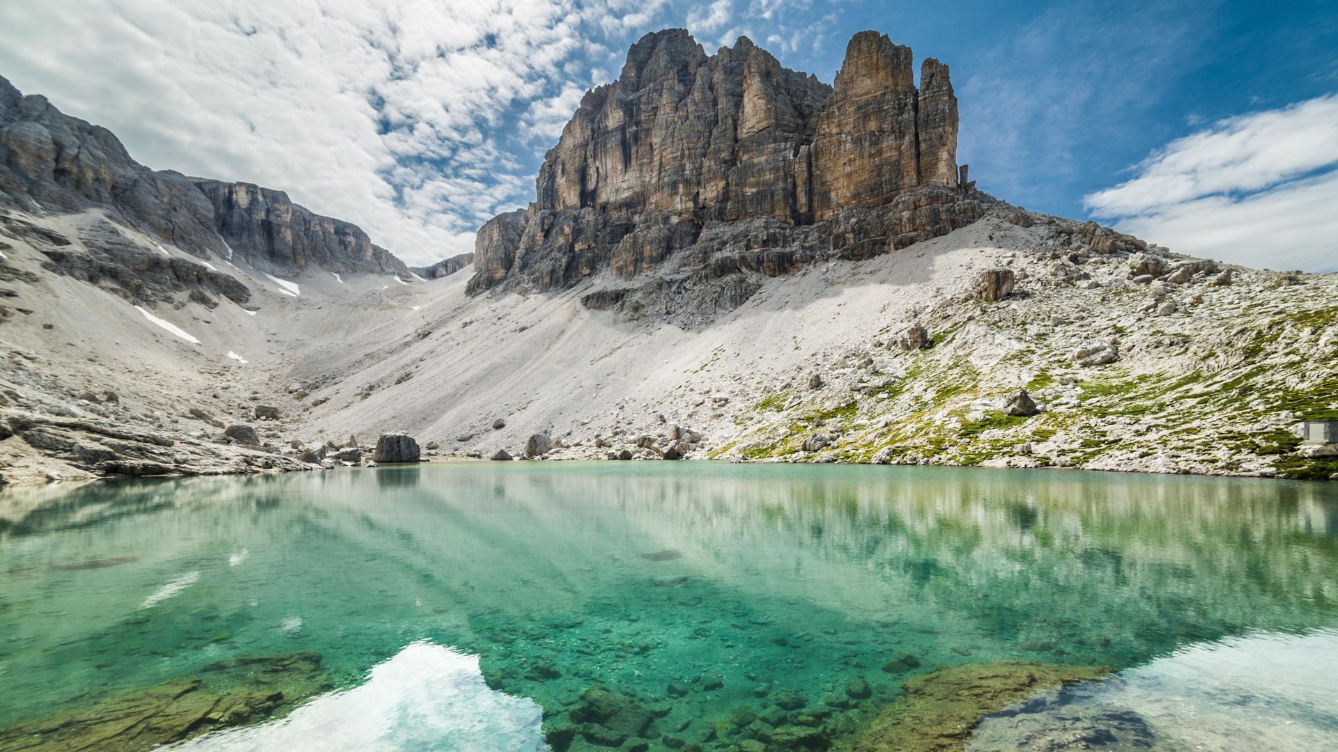 Zoom
Zoom 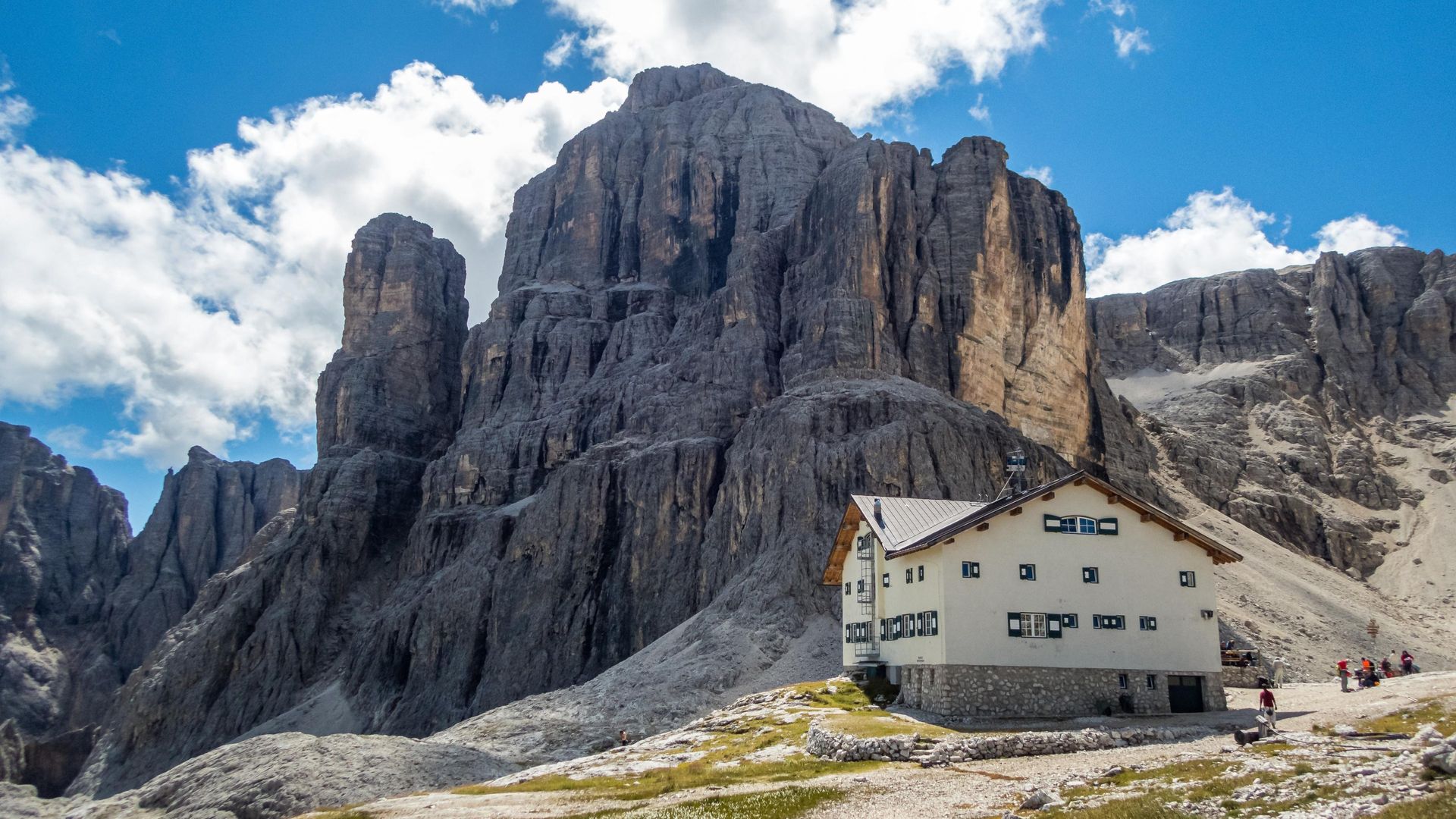 Zoom
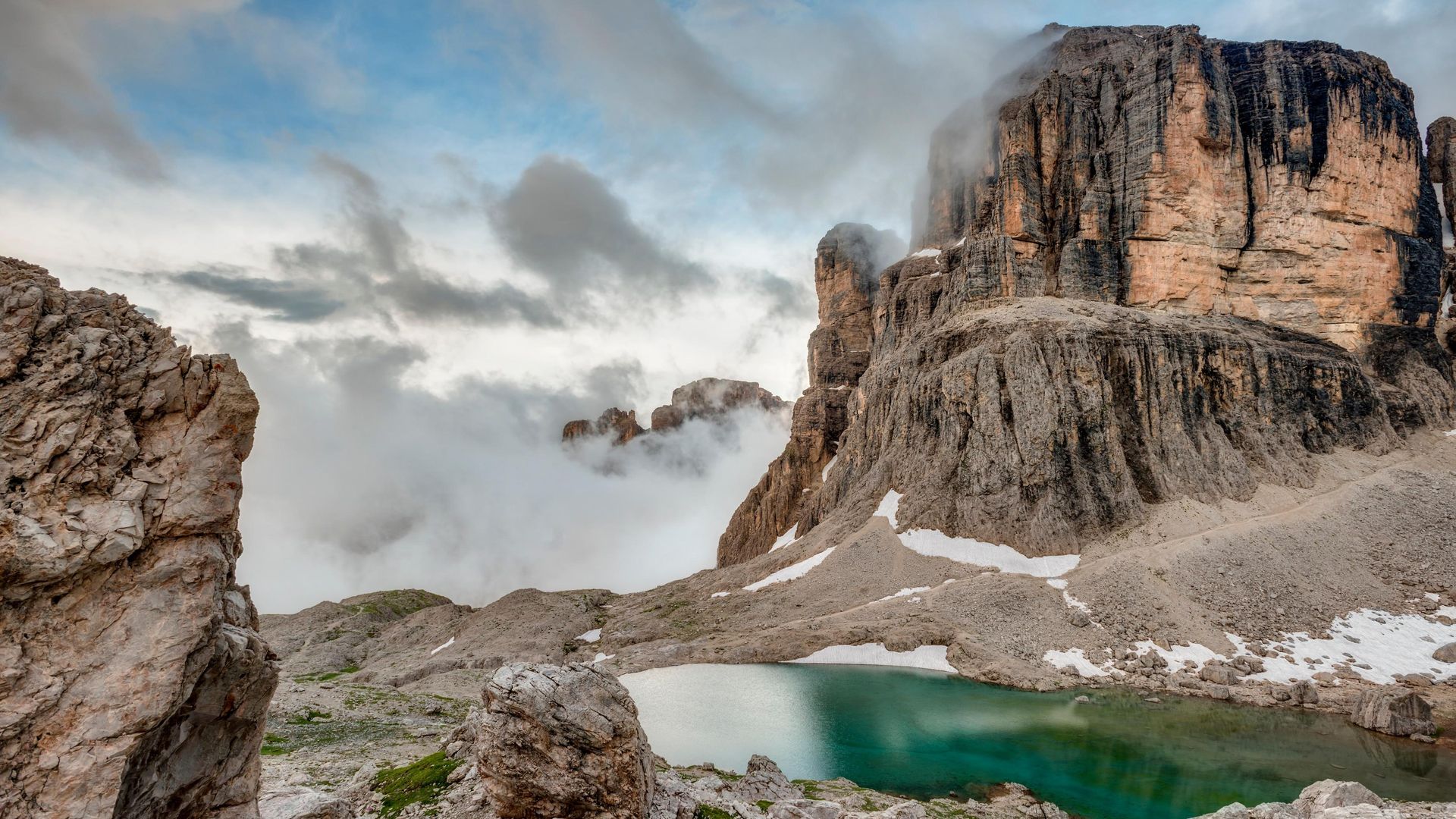
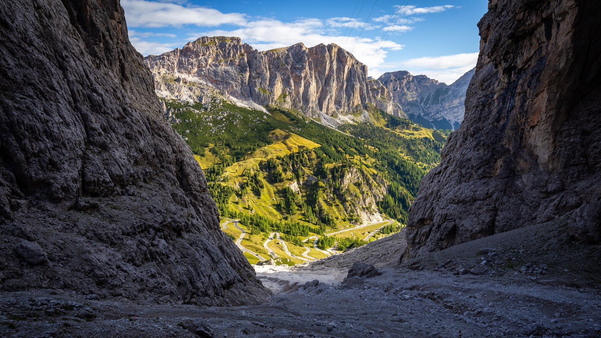
Zoom From here you can probably sense that Gardena Pass, the end of the tour, is not much farther, but don't let your guard down: coming up is the descent through spectacular Val Setus, a deep valley flanked by very high, steep walls. This might constitute the most difficult stretch of the entire excursion, so don't underestimate it!
From Rifugio Cavazza, continue along path Nr. 666 in westward direction and dive to the right into Val Setus. The first section will take you through a steep and rocky landscape, to be overcome with the help of steel ropes. Finally you'll reach the gorge below and continue to descend, until the valley finally opens up and the pass road comes into sight. It's not unlikely to find snow in this area until late July, but as the trail is very popular, there are usually some tracks you can follow. Good shoes and safety gear are mandatory equipment for this tour.
We recommend not following trail Nr. 666A to the large parking lot below, but to turn left along path Nr. 666 and reach the top of Passo Gardena, where you can call a taxi or take the bus that will take you back to Val Gardena.
Insider tip
The crossing of the Sella is one of the most spectacular tours in Val Gardena, which is why many hikers save it for the end of their holiday. It's important to be prepared for this challenge. Since Sas Pordoi is easily reachable by ropeway, the crossing is easy to access even to those who don't have the necessary preparation. Remember that you'll be hiking all day at altitudes around 3,000 m/10,000 ft!
Weather conditions must also be carefully monitored. In the event of thunderstorms, there are no shelters on extended parts of the Sella plateau and in the deep gorge of Val Setus. The state of the snow must likewise be taken into account. In the early summer months, many areas are still covered and the same goes for September, when even a few centimeters of snowfall won't melt for a long time. Be informed and be prepared!
Maps
- Tabacco Nr.05, Gröden-Val Gardena or Nr. 07, Alta Badia, Arabba, Marmolada. The tabacco maps are available in their app.
- AV-Map Nr. 52/I


